Project
Community
News
My App
My maps
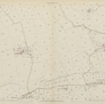
Somerset LXIX.NW - OS Six-Inch Map
1929
Ordnance Survey
1:11k
Somerset LXIX.NW - OS Six-Inch Map
1902
Ordnance Survey
1:11k
Somerset LXIX.NW - OS Six-Inch Map
1887
Ordnance Survey
1:11k
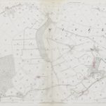
Somerset LIX.SW - OS Six-Inch Map
1902
Ordnance Survey
1:11k
Somerset LIX.SW - OS Six-Inch Map
1887
Ordnance Survey
1:11k
Somerset LIX.13 (includes: Clatworthy; Huish Champflower; Wiveliscombe Without) - 25 Inch Map
1902
Ordnance Survey
1:3k
Somerset LIX.13 (includes: Clatworthy; Huish Champflower; Wiveliscombe Without) - 25 Inch Map
1887
Ordnance Survey
1:3k
Somerset LXIX.1 (includes: Chipstable; Huish Champflower; Wiveliscombe Without; Wiveliscombe) - 25 Inch Map
1930
Ordnance Survey
1:3k
Somerset LXIX.1 (includes: Chipstable; Huish Champflower; Wiveliscombe Without; Wiveliscombe) - 25 Inch Map
1902
Ordnance Survey
1:3k
Somerset LXIX.1 (includes: Chipstable; Huish Champflower; Wiveliscombe Without; Wiveliscombe) - 25 Inch Map
1887
Ordnance Survey
1:3k
History
Old maps of Wiveliscombe
Discover the past of Wiveliscombe on historical maps
Old maps of Wiveliscombe
Discover the past of Wiveliscombe on historical maps
Explore Maps
Discover History
Parent places
Somerset
Related places