Project
Community
News
My App
My maps
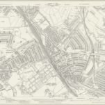
Hertfordshire XLVI.13 (includes: East Barnet; Finchley; Friern Barnet; Southgate; Wood Green) - 25 Inch Map
1936
Ordnance Survey
1:3k
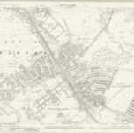
Hertfordshire XLVI.13 (includes: East Barnet; Finchley; Friern Barnet; Southgate; Wood Green) - 25 Inch Map
1912
Ordnance Survey
1:3k
Middlesex VII.13 (includes: East Barnet; Friern Barnet; Southgate; Wood Green) - 25 Inch Map
1911
Ordnance Survey
1:3k
Hertfordshire XLVI.SW - OS Six-Inch Map
1938
Ordnance Survey
1:11k
Hertfordshire XLVI.SW - OS Six-Inch Map
1912
Ordnance Survey
1:11k
Middlesex VII.SW - OS Six-Inch Map
1894
Ordnance Survey
1:11k
London Sheet C - OS Six-Inch Map
1913
Ordnance Survey
1:11k
Middlesex VII - OS Six-Inch Map
1863
Ordnance Survey
1:11k
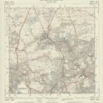
TQ29 - OS 1:25,000 Provisional Series Map
1938
Ordnance Survey
1:25k
Chipping Barnet
1805
History
Old maps of New Southgate
Discover the past of New Southgate on historical maps
Old maps of New Southgate
Discover the past of New Southgate on historical maps
Explore Maps
Discover History
Parent places
Hertfordshire
Related places