Project
Community
News
My App
My maps
Maps of Larbert
Advanced search
All
Private
Favorites
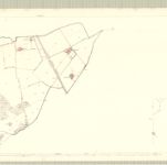
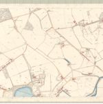
Stirling, Sheet XXIV.6 (with inset XXIV.10) (Dunipace) - OS 25 Inch map
1861|Ordnance Survey
1:2 500
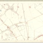
Stirling, Sheet XXIV.10 (Larbert) - OS 25 Inch map
1861|Ordnance Survey
1:2 500
Stirling, Sheet XXIV.14 (Combined) - OS 25 Inch map
1861|Ordnance Survey
1:2 500
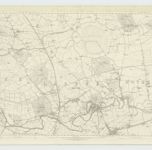
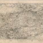
Stirlingshire, Sheet XXIV - OS 6 Inch map
1861|Ordnance Survey
1:10 560
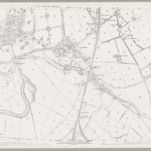
Stirling, Sheet XXIV.11 (Larbert) - OS 25 Inch map
1861|Ordnance Survey
1:2 500
Linlithgowshire.
1832|Thomson, John
1:55 000
Airdrie - OS One-Inch map
1855|Ordnance Survey
1:63 360
1600
1650
1700
1750
1800
1850
1900
1950
2000
History
Old maps of Larbert
Discover the past of Larbert on historical maps
Old maps of Larbert
Discover the past of Larbert on historical maps
Explore Maps
Discover History
Parent places
Falkirk (council area)
Related places
© MapTiler
© OpenStreetMap