Project
Community
News
My App
My maps
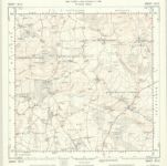
Hampshire & Isle of Wight XVI.NW - OS Six-Inch Map
1909
Ordnance Survey
1:11k
Hampshire & Isle of Wight XVI.NW - OS Six-Inch Map
1894
Ordnance Survey
1:11k
Hampshire and Isle of Wight VIII.13 (includes: Faccombe; Hurstbourne Tarrant; Vernhams Dean) - 25 Inch Map
1909
Ordnance Survey
1:3k
Hampshire and Isle of Wight VIII.13 (includes: Faccombe; Hurstbourne Tarrant; Vernhams Dean) - 25 Inch Map
1894
Ordnance Survey
1:3k
Hampshire and Isle of Wight XVI.1 (includes: Hurstbourne Tarrant) - 25 Inch Map
1909
Ordnance Survey
1:3k
Hampshire and Isle of Wight XVI.5 (includes: Hurstbourne Tarrant; Smannell; St Mary Bourne) - 25 Inch Map
1909
Ordnance Survey
1:3k
Hampshire and Isle of Wight XVI.5 (includes: Hurstbourne Tarrant; Smannell; St Mary Bourne) - 25 Inch Map
1894
Ordnance Survey
1:3k
Hampshire & Isle of Wight VIII.SW - OS Six-Inch Map
1909
Ordnance Survey
1:11k
Hampshire & Isle of Wight VIII.SW - OS Six-Inch Map
1894
Ordnance Survey
1:11k
SU35 - OS 1:25,000 Provisional Series Map
1938
Ordnance Survey
1:25k
History
Old maps of Hurstbourne Tarrant
Discover the past of Hurstbourne Tarrant on historical maps
Old maps of Hurstbourne Tarrant
Discover the past of Hurstbourne Tarrant on historical maps
Explore Maps
Discover History
Parent places
Test Valley
Related places