Project
Community
News
My App
My maps
RAF Aerial Collection (1945 - 1949)
1947
RAF
1:5k
RAF Aerial Collection (1945 - 1949)
1947
RAF
1:5k
RAF Aerial Collection (1945 - 1949)
1947
RAF
1:5k
RAF Aerial Collection (1945 - 1949)
1947
RAF
1:5k
RAF Aerial Collection (1945 - 1949)
1947
RAF
1:5k
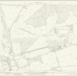
Hertfordshire XLVI.1 (includes: East Barnet; Enfield St Andrew; Monken Hadley; Southgate) - 25 Inch Map
1936
Ordnance Survey
1:3k
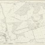
Hertfordshire XLVI.1 (includes: East Barnet; Enfield St Andrew; Monken Hadley; Southgate) - 25 Inch Map
1912
Ordnance Survey
1:3k
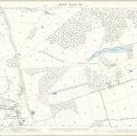
Middlesex VII.1 (includes: Enfield St Andrew; Southgate) - 25 Inch Map
1911
Ordnance Survey
1:3k
Hertfordshire XLVI.1 (includes: East Barnet; Enfield St Andrew; Monken Hadley; Southgate) - 25 Inch Map
1897
Ordnance Survey
1:3k
RAF Aerial Collection (1945 - 1949)
1946
RAF
1:5k
History
Old maps of Hadley Wood
Discover the past of Hadley Wood on historical maps
Old maps of Hadley Wood
Discover the past of Hadley Wood on historical maps
Explore Maps
Discover History
Parent places
Hertfordshire
Related places