Project
Community
News
My App
My maps
Maps of Crawley
Advanced search
All
Private
Favorites
Sussex III - OS Six-Inch Map
1874|Ordnance Survey
1:10 560
Surrey XLI - OS Six-Inch Map
1870|Ordnance Survey
1:10 560
Sussex IV - OS Six-Inch Map
1873|Ordnance Survey
1:10 560
Sussex IV.10 (includes: Worth) - 25 Inch Map
1874|Ordnance Survey
1:2 500
Sussex III.14 (includes: Lower Beeding; Rusper) - 25 Inch Map
1873|Ordnance Survey
1:2 500
Surrey XLII - OS Six-Inch Map
1870|Ordnance Survey
1:10 560
Reuben Ramble's Travels in the Southern Counties of England
1845|RAMBLE, Reuben pseud. [i.e. Samuel Clark.]
1600
1650
1700
1750
1800
1850
1900
1950
2000
History
Old maps of Crawley
Discover the past of Crawley on historical maps
Old maps of Crawley
Discover the past of Crawley on historical maps
Explore Maps
Discover History
Parent places
West Sussex
Related places
© MapTiler
© OpenStreetMap
 1874|Ordnance Survey1:10 560
 1870|Ordnance Survey1:10 560
 1873|Ordnance Survey1:10 560
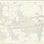 1874|Ordnance Survey1:2 500
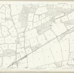 1873|Ordnance Survey1:2 500
 1870|Ordnance Survey1:10 560
 1845|RAMBLE, Reuben pseud. [i.e. Samuel Clark.]